Whale Report Alert System (WRAS)
The WRAS is creating safer waters for whales, with over 200,000 whale encounters mitigated for ship strike risk
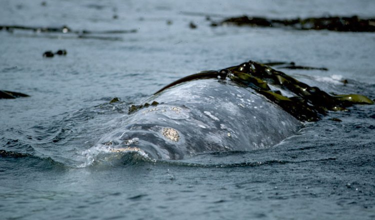
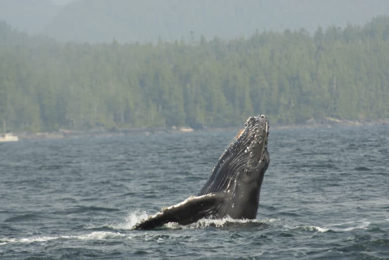
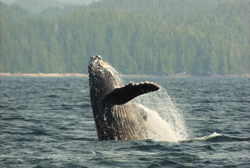
Safer Waters for Whales
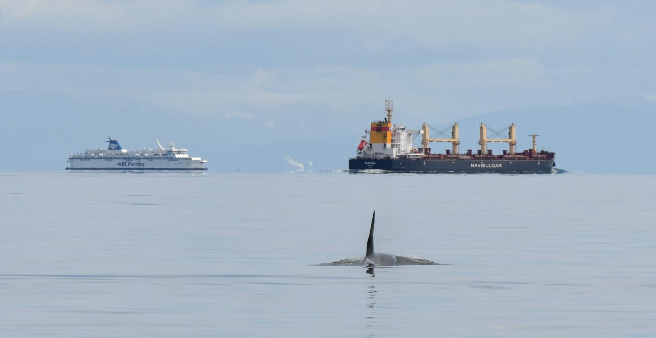
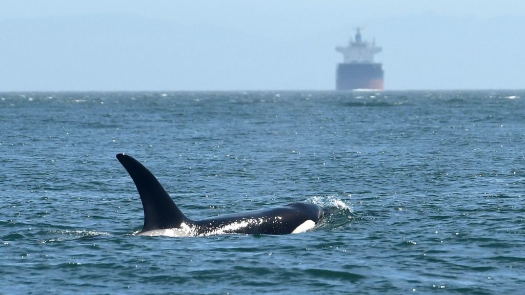
Ship strikes are the main driver of human-caused injury and death to large whales globally. Vessel traffic has increased by 300% in the past two decades and this number will continue to rise. As large vessels are increasingly transiting through prime whale habitat, the number of collisions with whales are becoming more and more frequent, with up to 20,000 fatal strikes annually.
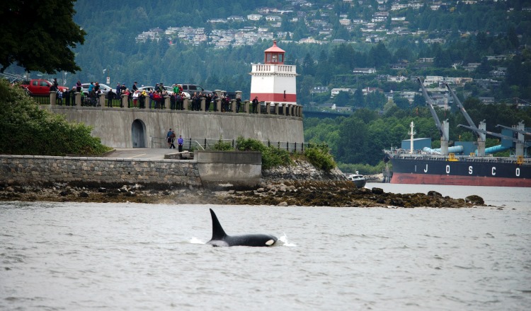
The Whale Report Alert System (WRAS) is a cutting-edge conservation tool designed to protect whales from ship strikes and disturbance by alerting mariners to their presence in real time.
Get Involved - Access the WRAS
Key Features of the Whale Report Alert System
Created by Mariners, for Mariners
The WRAS was created by a working group of professional mariners and its enhancement continues to be guided by an advisory committee of researchers, mariners, and industry professionals. The continued participation of marine industry ensures that the WRAS is optimized for use on the water and that information about whale presence is convenient, accessible, and actionable for large ships.
Real-Time Alerts
Mariners receive timely notifications about the presence of whales within ten nautical miles of their vessel. It takes less than two minutes for a detection to create an alert. Mariners can create an additional zone of interest and can customize alert delivery through text, push notification, and/or email.
High-Accuracy, 24/7 Detection
Our Application Programming Interface (API) enables the integration of technologies from a wide variety of partner data providers to improve the system's ability to detect whales and provide timely alerts to mariners.
Methods of Whale Detection
Infrared Cameras
WhaleSpotter uses thermal imaging to detect the heat signatures of whales when they surface to breathe, even in low visibility conditions and at night. Artificial intelligence is used to single out the whales and each detection is verified in real-time by trained observers. This technology significantly enhances the WRAS's accuracy at night and in poor weather.

Hydrophones
Underwater microphones capture the sounds made by whales, allowing trained machine learning algorithms to identify detection events which automatically trigger real time WRAS alerts. This is particularly useful in areas where visual detection is challenging. JASCO Applied Sciences and SMRU Consulting currently supply real-time hydrophone data to the WRAS.
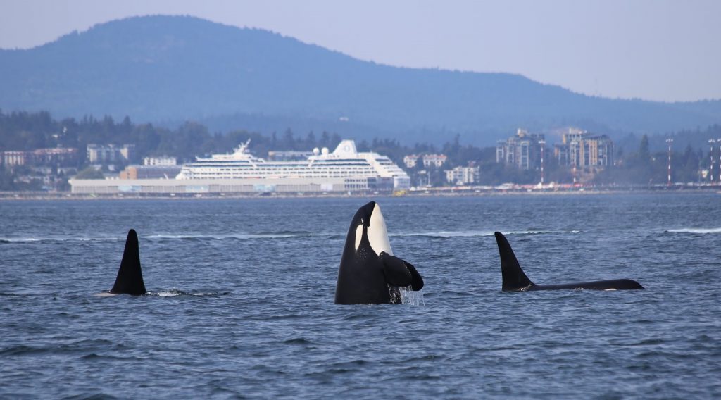
Send a Sighting, Save a Whale!
While only registered large commercial vessels are authorized to receive WRAS alerts, community members can get involved by reporting their whale sightings. This can be done through the Ocean Wise Whale Report App, or via partner sightings networks such as Orca Network, the Acartia Data Cooperative (conserve.io), and Whale Alert Alaska.
Frequently Asked Questions
Data Providers
Acartia.io
Ocean Wise has partnered with Acartia.io data cooperative to provide increased marine mammal detections into the WhaleReport Alert System, particularily in Washington State. Acartia is a decentralized data cooperative for sharing marine animal locations within the Salish Sea. It is named for one of the smallest animals in Puget Sound - microscopic copepods - but was built to recover one of the biggest - the endangered Southern Resident killer whales.
Acartia.ioOrca Network
Orca Network is dedicated to raising awareness about the whales of the Pacific Northwest, the importance of providing them with healthy and safe habitat, and finding ways for people to work together to protect the rich, beautiful, and diverse Salish Sea. Orca Network provides data into the WhaleReport Alert System via Acartia.io.
orcanetwork.org
Conserve.io
Conserve.io is bringing conservation into the 21st century by deploying a mix of mobile, web and crowdsourcing technology to simplify and scale the collection of conservation data and to make that data more actionable. Conserve.io provides data into the WhaleReport Alert System via Acartia.io.
conserve.io
Beam Reach
Beam Reach catalyzes marine conservation wherever endangered salmon-eating orcas roam — from northern California to southeast Alaska. Based in Seattle, we are bioacoustic experts who create innovative technological solutions with our non-profit, government, and industry partners to help save the whales. Beam Reach provides data into the WhaleReport Alert System via Acartia.io.
beamreach.blue
Whale Alert
The Whale Alert app was launched in 2012 as a citizen science tool aimed at reducing the risk of vessel strikes. It empowers users to report whale sightings via an accessible interface, and informs users of speed zones, warnings, and other measures to reduce vessel speeds and reduce risks to whales and mariners.
whalealert.org
SMRU Consulting
SMRU Consulting is a global leader in marine mammal consulting and research, delivering innovative, robust and environmentally sound solutions to clients active in the marine environment. They have extensive experience in carrying out research into many facets of marine mammal biology, including acoustic analyses.
smruconsulting.com
Jasco Applied Sciences
JASCO Applied Sciences provides consulting and research services for assessing and mitigating underwater noise. Since its origin in 1981, JASCO has been developing and implementing acoustic technologies ranging from advanced acoustic recorder design to complex acoustic and behavioural modelling algorithms to comprehensive field monitoring and data analysis, including acoustic detection of marine mammals and human sources.
jasco.comWhaleSpotter
WhaleSpotter offers automated marine mammal detection to prevent vessel strikes and reduce noise impacts. Whether operating vessels, dredging, or laying cable, it ensures marine life is protected. Designed for accuracy and ease of use, it's backed by scientific research and real-world deployments, helping humans and marine mammals coexist safely in shared waters.
whalespotter.aiTrelleborg Marine and Infrastructure
Trelleborg’s portfolio of SafePilot solutions includes various portable navigation systems that provide ports with important, real-time navigation information that gives pilots greater control, safety and accuracy during port approach and maneuvers. Built in collaboration with marine pilots worldwide, all SafePilot solutions utilize touchscreen technology and are known for their intuitive ease-of-use, offering pilots the most modern and professional tool for pilotage operations.
trelleborg.comFunders